
easyrtk
GS-2000N LiDAR Scanning System 7 Echos Long Detection Aerial VTOL Mapping High Accuracy
GS-2000N LiDAR Scanning System 7 Echos Long Detection Aerial VTOL Mapping High Accuracy
Couldn't load pickup availability
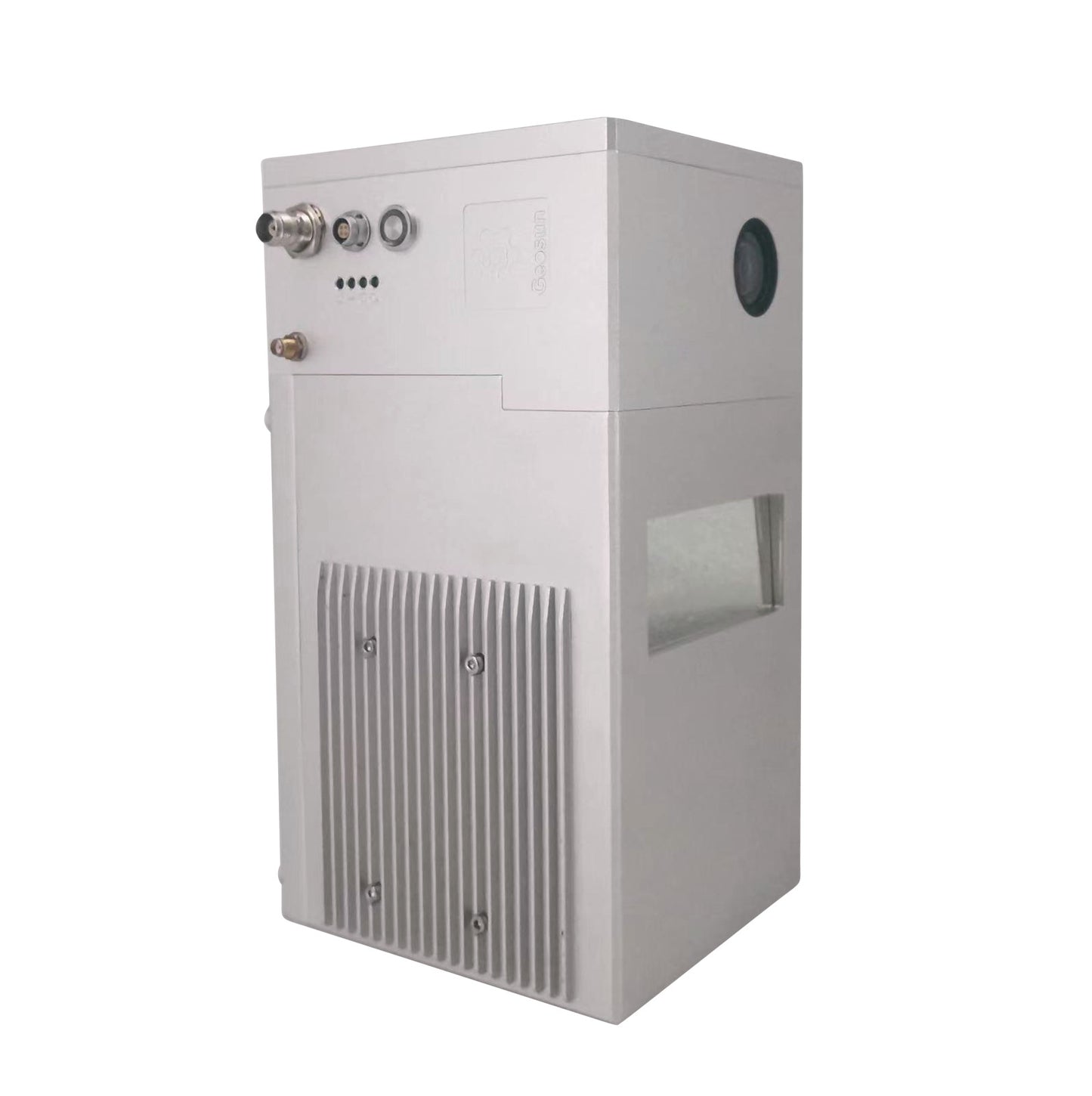
gAirHawk Series GS-2000N LiDAR Scanning System
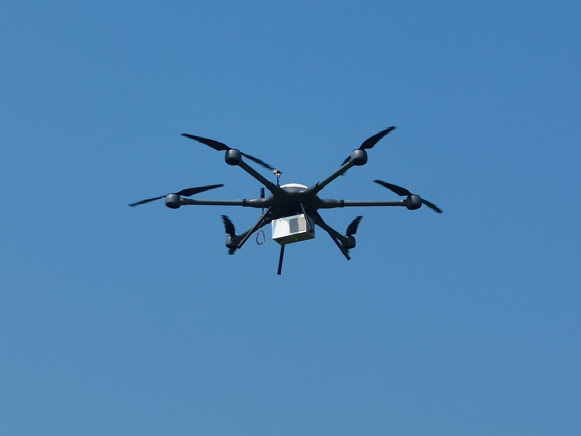
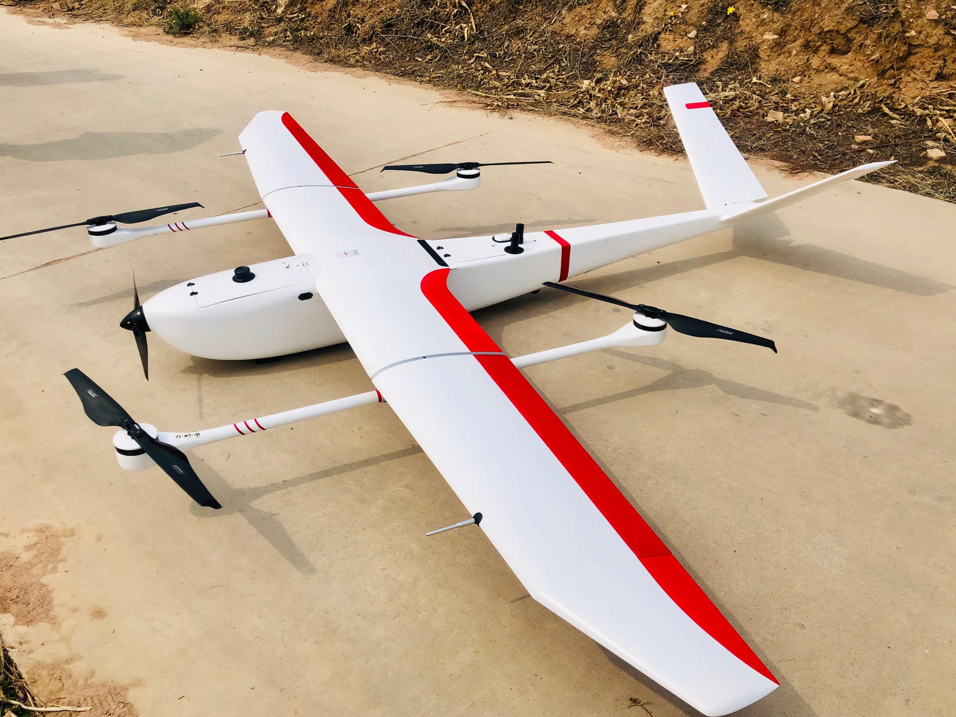
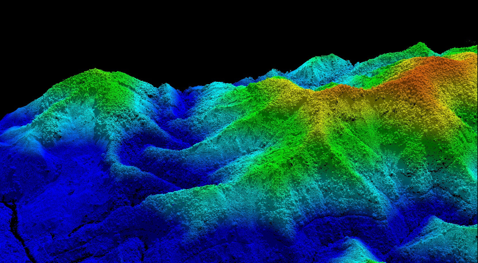
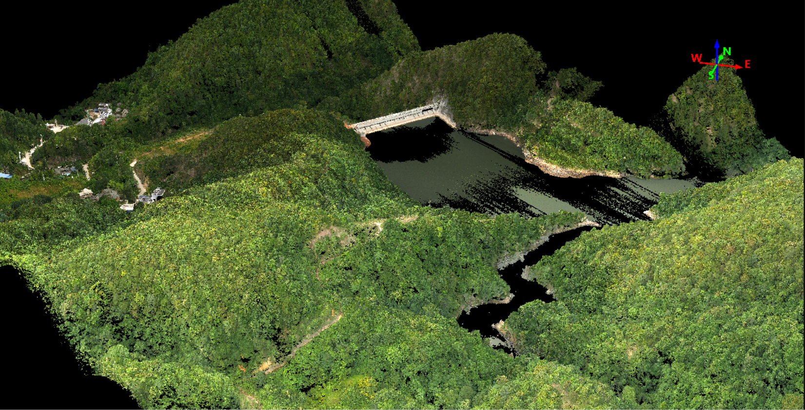
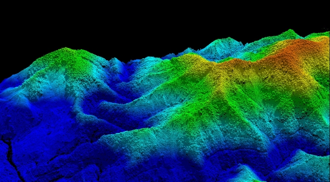
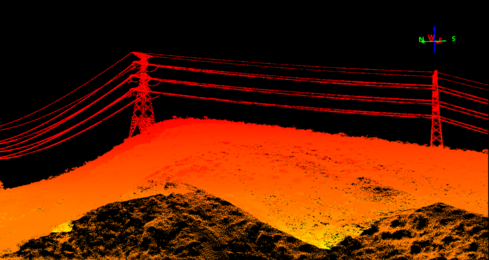
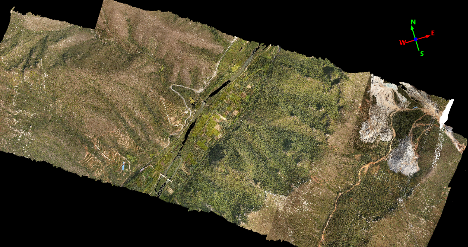
gAirHawk GS-2000N is a kind of long range, compact LiDAR point cloud data acquisition system, integrated FT-1500H long range laser scanner, GNSS and IMU positioning and attitude determination system, and storage control unit, is able to real-time, dynamically, massively collect high-precision point cloud data and rich image information. It is widely used in the acquisition of 3D spatial information in surveying, electricity, forestry, agriculture, land planning.
Specification of LiDAR Scanning System gAirHawk GS-2000N
|
LiDAR scanning system gAirHawk GS-2000N |
||
|
|
Item Name |
System Parameters |
|
Parameters |
Weight |
3.2kg |
|
Working temperature |
-20℃~+60℃ |
|
|
Power range |
12 V- 24 V |
|
|
Consumption |
65 W |
|
|
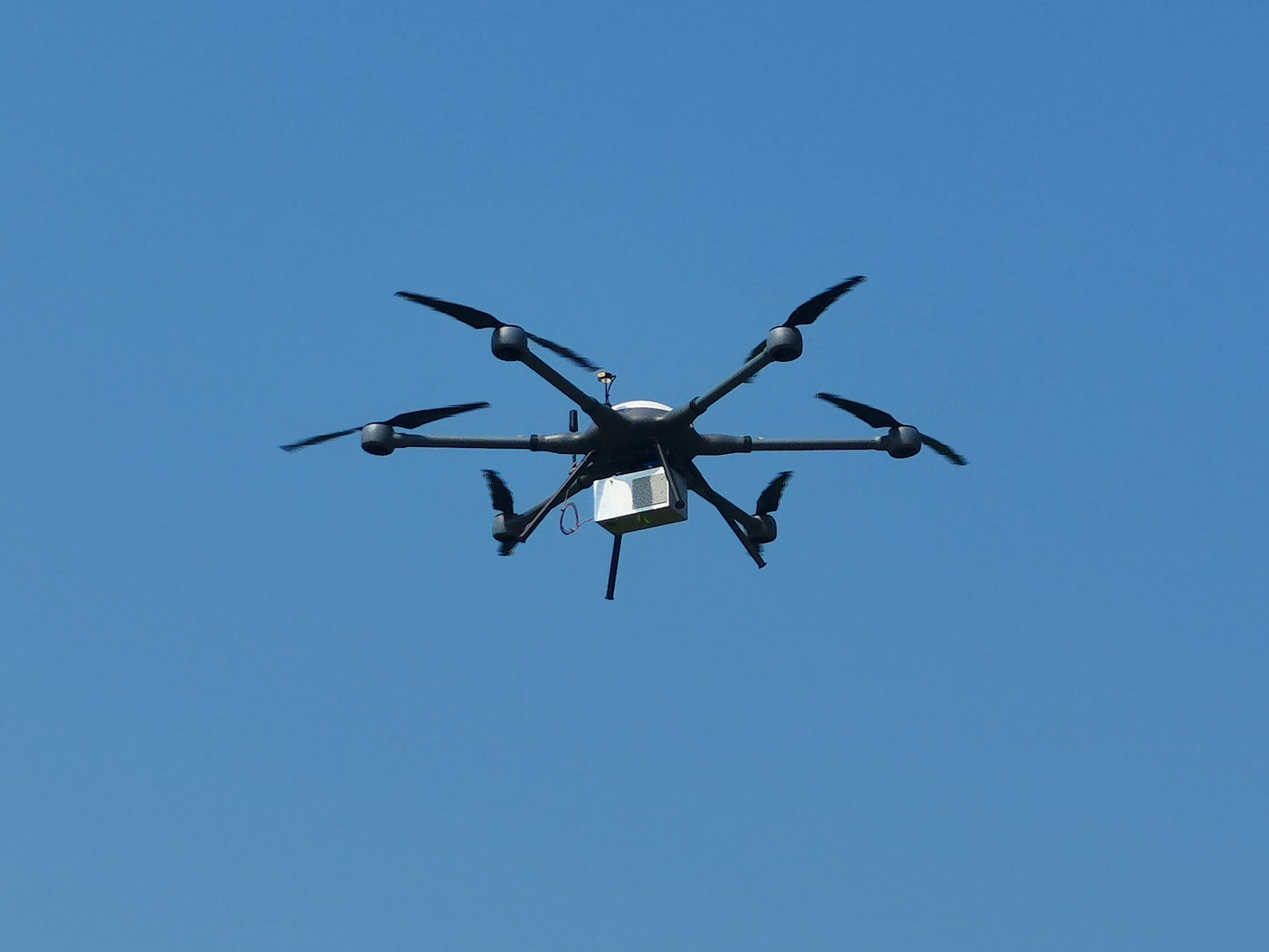
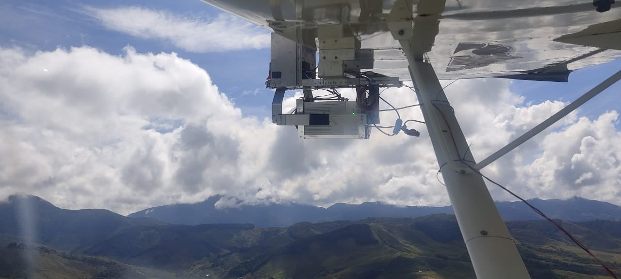
Carrying Platform |
6 Aixs Multi Rotor Drone,VTOL |
|
|
Storage |
64 GB storage, maximum support 128GB TF card |
|
|
Laser Unit |
Measuring Range |
2000m@80% |
|
Laser class |
1550 nm Class1 (IEC 60825-1:2014) |
|
|
Laser line number |
FT-1500H Single-Beam |
|
|
Measuring accuracy |
3mm@100m |
|
|
Max. range |
2000m |
|
|
Return |
Seven echos |
|
|
Scanning frequency |
50HZ-2000HZ |
|
|
Beam Divergence |
0.3mrad |
|
|
FOV |
75°-90°, adjustable |
|
|
POS Unit |
Update frequency |
200HZ |
|
Heading accuracy |
0.010° |
|
|
Pitch accuracy |
0.003° |
|
|
Rolling accuracy |
0.003° |
|
|
Position accuracy |
Horizontal: 0.01m, Vertical: 0.02m |
|
|
GNSS signal type |
GPSL1/L2/L5 GLONASSL1/L2 BDS B1/B2/B3 GAL E1/E5a/5b |
|
|
IMU |
gSpin 410 |
|
|
Pre-processing software |
POS software |
Output information: position, speed, attitude |
|
Point cloud software |
Output point cloud data format: LAS format, custom TXT format |
|
|
Camera (built-in) |
FOV |
79 Degree |
|
Effective Pixel |
45 MP (Full Frame Camera) |
|
|
focal Length(mm) |
16 |
|
Applications of LiDAR Scanning System gAirHawk GS-2000N
Free Trial Software LiDAR Scanning System gAirHawk GS-2000N
Free trial test, achieve high precision
The Guideline of LiDAR Usage and Reference.pdf
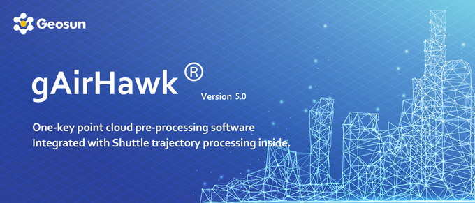
Point Cloud Pre-Processing Software Integrated With Trajectory Processing----Geosun Self-developed gAirHawk 5.0
Key Features of gAirHawk 5.0 Software
1. Raw data: intelligently load
2. Four default coordinates
3. Point cloud Optimization
4. Start and stop calculation
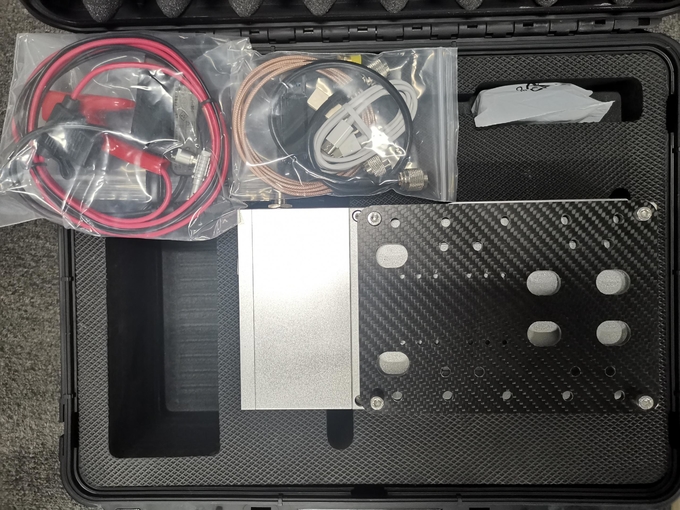
Package of LiDAR Scanning System gAirHawk GS-2000N
LiDAR Scanning System gAirHawk GS-2000N is packed by suit case with EVA material liner inside, then covered by hard carton box.
The pacakge of uav LiDAR scanning system is suitable for air shipment and sea shipment.